giriiş
This manual provides detailed instructions for the operation and maintenance of your Garmin GPSMAP 78sc 2.6-Inch Waterproof Marine GPS and Chartplotter. The GPSMAP 78sc series is designed for recreational navigation, featuring a bright 2.6-inch LCD color display, built-in basemap, and a high-sensitivity GPS receiver. All models are waterproof to IPX7 standards and float in water, making them suitable for boating and watersports. Key features include a built-in microSD card slot for additional maps and a dedicated Man Over Board (MOB) button.
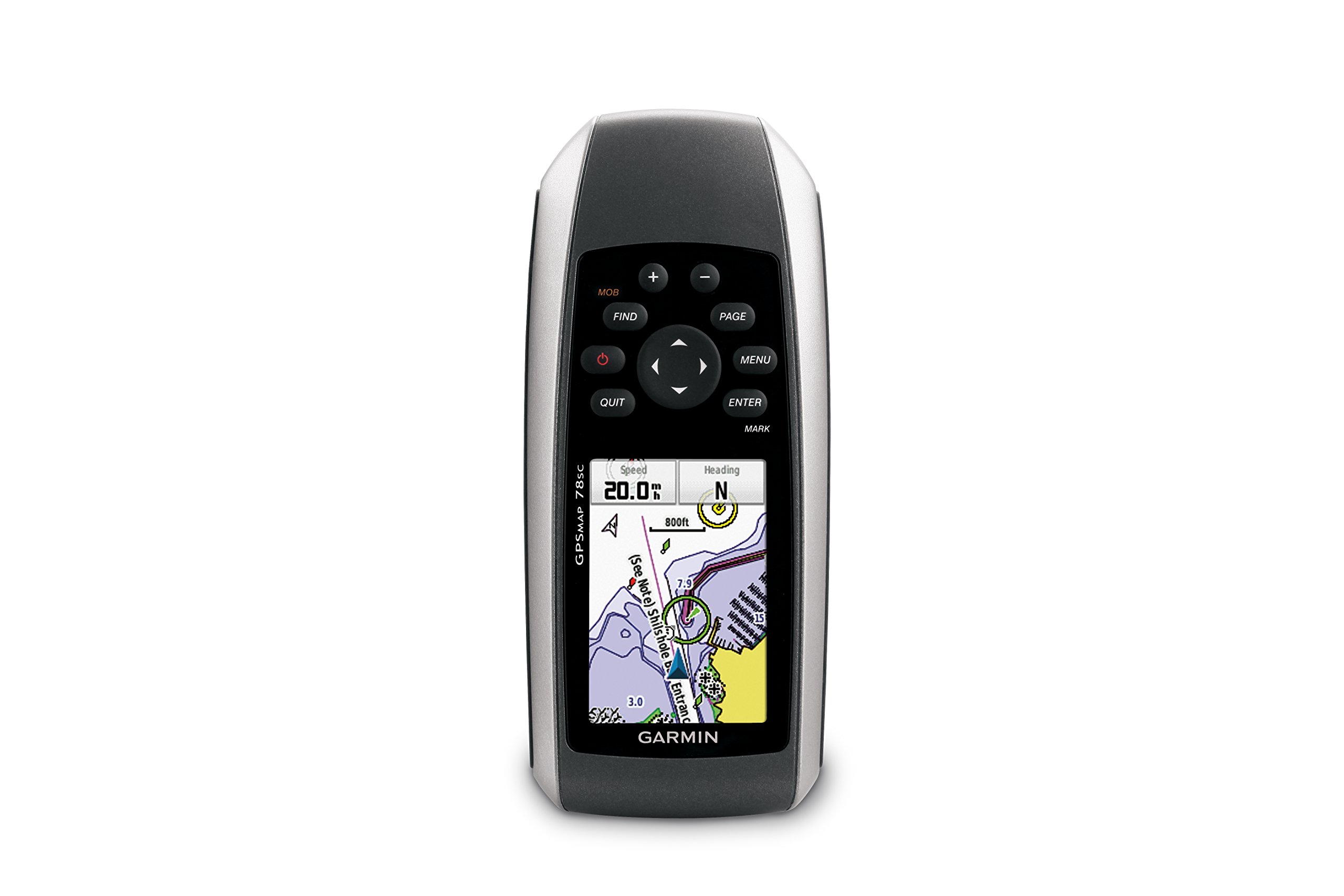
Şekil 1: Ön view of the Garmin GPSMAP 78sc handheld marine GPS and chartplotter.
Ürün Bittiview
Temel Özellikler:
- Marine-friendly handheld with high-sensitivity GPS receiver and 2.6-inch color TFT display.
- Waterproof to IPX7 standards; floats in water.
- Built-in BlueChart g2 U.S./Bahamas coastal charts with shorelines, depth contours, navaids, harbors, marinas, and more.
- Built-in 3-axis tilt-compensated electronic compass and barometric altimeter for heading, altitude, and weather information.
- Wireless sharing of waypoints, tracks, routes, and geocaches with other compatible devices.
Kutuda Neler Var:
- GPSMAP 78sc device
- Bilek kayışı
- USB kablosu
- Manuel

Şekil 2: Açısal view of the Garmin GPSMAP 78sc, highlighting its button interface.
Ürün Videoları:
Garmin GPSmap 78 handheld GPS Overview
Bu video genel bir bakış sağlarview of the Garmin GPSMAP 78 handheld GPS, demonstrating its features and design.
Ürün Bittiview Video
A concise product overview video from the seller, highlighting key aspects of the device.
Kurmak
1. Pillerin Takılması:
The GPSMAP 78sc operates on two AA batteries (not included). To install:
- Cihazın arkasındaki pil bölmesi kapağını bulun.
- Twist the D-ring counter-clockwise to unlock and remove the cover.
- İki adet AA pili, doğru kutuplara (+ ve -) dikkat ederek takın.
- Kapağı yerine takın ve D halkasını saat yönünde çevirerek sabitleyin.

Şekil 3: Geri view of the Garmin GPSMAP 78sc, illustrating the battery compartment.
2. Açma/Kapatma:
Basılı tutun Güç button (located on the left side) to turn the device on or off. A short press will adjust the backlight.
3. Initial Settings:
Upon first use, the device may prompt you to set language, time zone, and other preferences. Follow the on-screen instructions using the directional pad and GİRMEK düğme.
İşletim
Navigation Basics:
- Ana Menü: Basın MENÜ button twice to access the main menu.
- Sayfa Düğmesi: Basmak SAYFA to cycle through the main pages (Map, Compass, Trip Computer, etc.).
- Yön Tuşu: Use the directional pad to scroll through menus, pan the map, or adjust settings.
- GİRİŞ Düğmesi: Basmak GİRMEK to select an item or confirm an action.
- QUIT Button: Basmak ÇIKIŞ YAPMAK to return to the previous page or cancel an action.
Creating Waypoints:
To mark your current location as a waypoint:
- Basın İŞARET düğme.
- Edit the waypoint name, symbol, and coordinates if desired.
- Seçme Tamamlamak or Kaydetmek to store the waypoint.
Man Over Board (MOB) Function:
Acil bir durumda, tuşuna basın. Cep telefonu button to immediately mark the current location and initiate navigation back to that point. This feature is critical for safety in marine environments.
Bakım
Cihazın Temizlenmesi:
Cihazı bir bezle silinampened with a mild detergent solution. Dry thoroughly. Avoid using abrasive cleaners or solvents that could damage the device's finish or screen.
Pil Bakım:
Always use fresh, high-quality AA batteries. If the device will not be used for an extended period, remove the batteries to prevent leakage and corrosion.
Yazılım Güncellemeleri:
Garmin cihazınızı düzenli aralıklarla kontrol edin. website for software updates to ensure optimal performance and access to the latest features. Updates can typically be installed by connecting the device to a computer via the USB cable.
Sorun giderme
Cihaz Açılmıyor:
- Pillerin doğru şekilde takıldığından ve tam şarjlı olduğundan emin olun.
- Try new batteries.
- Pil kontaklarında korozyon olup olmadığını kontrol edin.
Zayıf GPS sinyali:
- Cihazın açık olduğundan emin olun view gökyüzünün.
- Avoid areas with tall buildings, dense foliage, or other obstructions.
- Allow sufficient time for the device to acquire satellites, especially after being off for a long period.
Ekran Yanıt Vermiyor:
- Pilleri çıkarıp tekrar takarak yazılım sıfırlaması yapın.
- Ekranın temiz ve kalıntılardan arınmış olduğundan emin olun.
Özellikler
| Özellik | Detay |
|---|---|
| Marka | Garmin |
| Model Adı | GPSHARİTA |
| Model Numarası | 010-00864-02 |
| Ekran Boyutu | 2.6 inç |
| Görüntü Türü | LCD |
| Çözünürlük | 160 x 240 piksel |
| Su Geçirmezlik Derecesi | IPX7 (floats) |
| Pil Ömrü | 20 Hours (typical) |
| Pil Türü | 2 adet AA pil (dahil değildir) |
| Bellek Depolama Kapasitesi | 1 GB |
| Compatible Flash Memory Type | microSD |
| Desteklenen Uydu Navigasyon Sistemi | Küresel Konumlama Sistemi |
| Özel Özellikler | Rugged case, Barometric altimeter, Garmin Connect compatible, Electromagnetic compass, Garmin HotFix, Custom POIs, Automatic routing, Hunt/fish calendar, Geocaching, Photo navigation |
| Ürün Boyutları U x G x Y | 2.6"U x 1.2"G x 6"Y |
| Ürün Ağırlığı | 7.7 Ons |
Garanti ve Destek
The Garmin GPSMAP 78sc comes with a 1 Year Limited Warranty. For detailed warranty information, product support, or service inquiries, please refer to the official Garmin website or contact Garmin customer service directly. The included manual also contains contact information and further support resources.